
In January 2023, Ladakh Archaeology was launched. This is to date the largest database on the heritage of Ladakh, located in the northern part of the Indian subcontinent. The comprehensive corpus houses over 160,000 images related to 1,900+ sites spread across the region. The variety of sites captured includes fortifications, temples, funerary sites, rock art, and chortens (Tib. mchod rten, Skt. stūpa).
The open access database is part of the Archaeological Exploration of Ladakh (AEL) project at the Research Centre for East Asian Civilisations (CRCAO, Paris). Directed by Quentin Devers, the project aims to conduct extensive surveys throughout Ladakh, documenting the sites connected to 5,000 years of history. An overview of AEL’s heritage-related projects (including a wonderful study of the funerary cave of the Old Lady Spider) can be found on the website.
Over the last two decades, there have been several projects conducted in Ladakh to uncover the region’s rich history and cultural heritage, and yet it remains under-studied. AEL hopes its vast database will not only preserve and manage information – unfortunately, several of the sites presented in the archive have since been destroyed or heavily damaged – but will also facilitate more research and study on Ladakh’s past.
The Ladakh Archaeology website is easy to navigate. Its collection is separated into eight categories: fortifications, petroglyphs & pictographs, Buddhist carvings, painted chortens, temples, nunneries (ruined & intact), stupa stones, chortens (regular), and others. The latter includes caves, settlement ruins, and tombs. Each category is then grouped into regions of Ladakh, which can be quickly accessed via links at the top of each category page.

The website provides a list of sites in alphabetical order with each entry linked to its corresponding page on NAKALA, an online archiving platform developed by the National Centre for Scientific Research (CNRS, Paris), Aix-Marseille University, and Campus Condorcet. The platform enables long-term preservation and the sharing and publication of data in accordance with the FAIR principles. Although NAKALA is straightforward to use, Ladakh Archaeology also provides a short manual on how to navigate it.
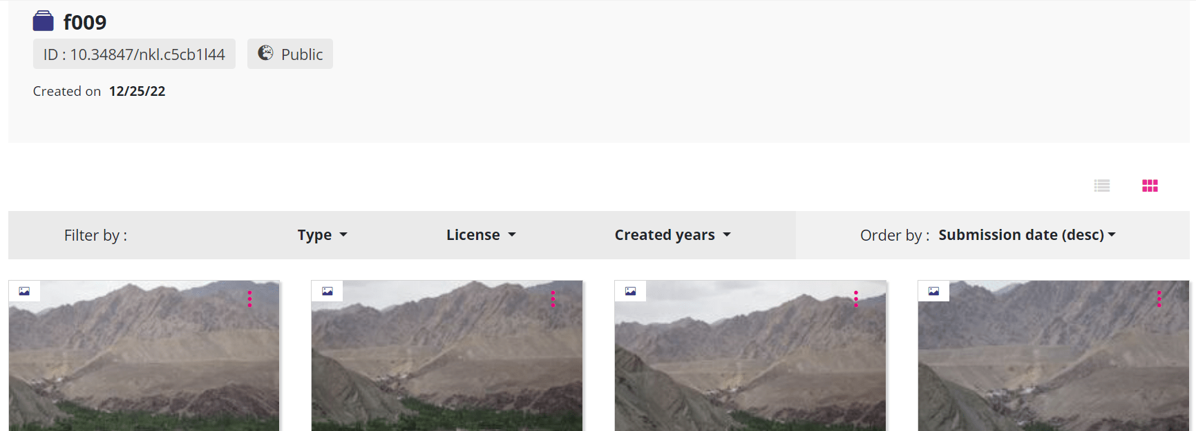
At the moment, the entries in NAKALA are scarce in terms of data: they contain only the NAKALA ID number and the images (for example, see Screenshot 2). The name of the location isn’t provided (unless you open an image), which can be a little confusing if you are just browsing. However, both the name and corresponding NAKALA ID number are given on the Ladakh Archaeology website (see Screenshot 1). The images themselves offer a little more information (location, coordinates, and the year the photograph was taken), although still limited.
The project plans to continue developing the database, adding detailed descriptions, bibliographies, and maps of the sites in time. For those who don’t want to/can’t wait, short descriptions and bibliographies of sites in Purig, Changthang, Nubra, and Zanskar have been published by AEL in a series of volumes in collaboration with the Indian National Trust for Art and Cultural Heritage (INTACH).
It is worth noting that users should not use the search tool in NAKALA unless they are searching with the NAKALA ID (e.g., you search ‘f009’ and not ‘Ratan Lhatse Khar’). As NAKALA is used by a range of projects searches are likely to bring up entries from outside Ladakh Archaeology, for example, a search of ‘fort’ returns 23,565 hits, including ‘Cheese production in Gaul during the Iron Age and the Roman period’! The same problem occurs if a keyword attached to an image is selected (see Screenshot 3).

The quantity and quality of images is impressive, with many entries featuring well over 100 photographs. One feature that I would like to see added to the NAKALA database is a navigation tool so that the user can move through images using a ‘next’ and ‘previous’ button. At present this is not possible, which requires returning to the database entry or search results to access the other images.
Alongside its database, Ladakh Archaeology has created an interactive map with Openstreetmap, which can be found at the top of each category page. This is a useful feature if you are looking for sites based on topographical features and/or want to visualise the locations of these sites. The map provides the name of the location, the NAKALA ID number, and a link to the database entry, and can be filtered by category type.

Ladakh Archaeology is a tremendous and much welcomed resource, which will undoubtedly prove to be a crucial tool for anyone working on the archaeology and heritage of Ladakh, as well as neighbouring regions. It is easy to use, functional, and offers useful features such as the interactive map. This vast database would not possible without the hard work of AEL, who are diligently working to document “as many sites as possible, before they vanish under the attack of sledgehammers and pneumatic drills: a site destroyed before it could be documented is doomed to remain unknown forever.”
One thought on “Ladakh Archaeology: Introduction and Review”