
This is a guest post by Eric H. C. Chow and Ryan Iu. For more information, see at the end of this post
In recent years, the study of early colonial Hong Kong has begun to actively engage in the development of digital humanities projects encompassing various historical topics. Scholars, particularly historians specializing in the history of early colonial Hong Kong, have harnessed the power of computational tools and online databases to make significant contributions to digital scholarships, enhancing research, teaching, and even simply visual representation. These efforts also seek to improve observations and generate new empirical evidence while also attempting to transfer information from the scholarly to the public historical domain. In this short post, we aim to provide an introductory overview of digital humanities tools, databases, and projects related to the history of early colonial Hong Kong (spanning from the establishment of British Hong Kong to its occupation by Japan during the Second World War). This overview is intended to serve as a resource guide for beginners who are interested in this field. These projects will be categorized into three main groups: textual databases for distant reading, Geographical Information System (GIS), and social network studies.
Textual Databases for Distant Reading
Archival research is a crucial approach employed by historians to study and write about the past; students or scholars have to frequently consult governmental documents and historical newspapers for their work. Online archival databases therefore become advantageous tools for them, saving them trips to visit the physical locations. Meanwhile, users can find specific texts in a scanned image or document using the ‘Optical Character Recognition’ (OCR) function in certain online textual databases and digitized historical newspapers, regardless of how accurate the function of locating the specific texts is. From the perspective of digital humanities, the time-saving OCR function enables academics to collect, organize, and manage massive data sets, as well as create databases for their digital humanities projects. Here are a few examples of textual databases related to the study of early colonial Hong Kong that may be accessed online.
The Hong Kong Government Reports Online serves as a vital platform for historians and digital humanities creators, providing a comprehensive online database featuring full-text images. This resource is particularly valuable for accessing government documents, specially Administrative Reports (1879-1939), Hong Kong Blue Book (1871-1940), Sessional Papers (1884-1940), Hong Kong Hansard (1890-1941), Hong Kong Government Gazette (1841-1940), etc. The earlier version of the platform allows the users to search for document titles while providing options to narrow down searches by dates and specific collections. In contrast, the newer version – hosted by the Digital Repository of the Hong Kong University Library – offers an enhanced feature allowing users to search within the full texts of the documents. Both versions are available online simultaneously. While the OCR function in the new version may not be perfectly accurate, it still proves to be a valuable time-saving tool for researchers seeking specific information or names within the documents. It allows the users to search within the full-texts of the documents. Nevertheless, the OCR function is not quite accurate, but it still saves time for researchers to locate certain information.
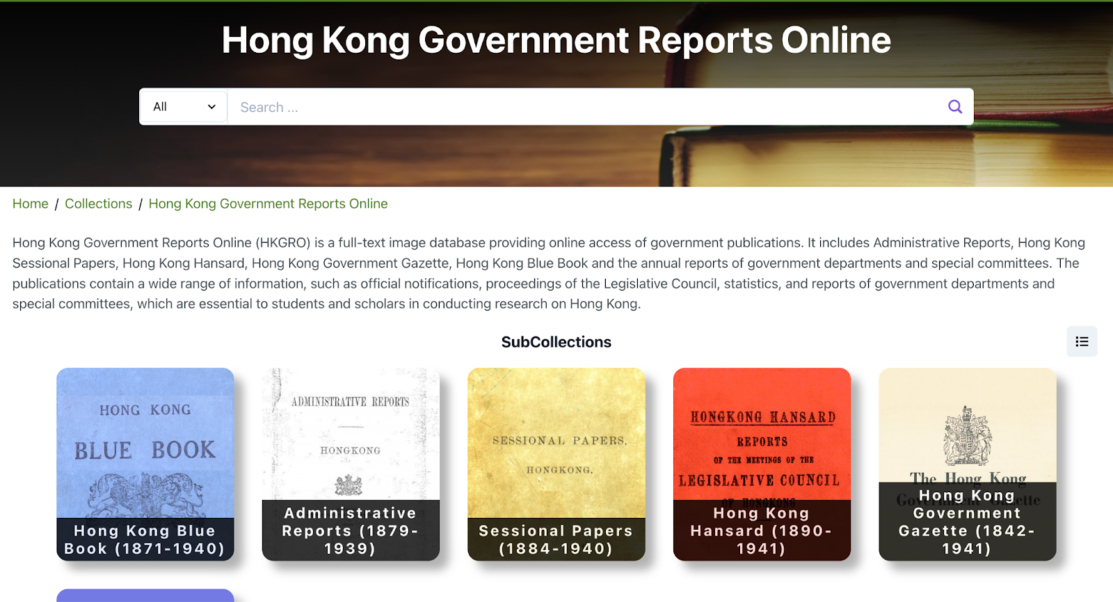
Figure 1: Hong Kong Government Reports Online (1942-1941)
Researchers and historians specializing in early Hong Kong are likely acquainted with the Colonial Office correspondence collection (CO 129). Comprising correspondence and despatches exchanged between the governors of Hong Kong and the Colonial Office in London between 1841 and 1951, this collection sheds light on the social, political, economic, and military development of Hong Kong. While the original documents are housed in the Public Record Office in Kew, London, the online database Gale Primary Sources has digitized the CO 129 series and made it accessible online. This digital platform incorporates a Handwritten Text Recognition (HTR) function, which allows the transformation of handwritten documents into fully searchable text, akin to the OCR function. Despite some inherent inaccuracies, this feature acts as a helpful finding aids for researchers and digital humanities creators, facilitating the search for specific keywords and individuals. It is worth noting that access to this database requires a subscription, and users need to pay to enjoy its services.

Figure 2: CO129 (China and the Modern World: Hong Kong, Britain and China, Part I: 1841-1951)
Newspapers and periodicals play a crucial role in scholarly examinations, and this holds true for the historical study of early colonial Hong Kong. The Old Hong Kong Newspaper Collection, hosted by the Hong Kong Public Libraries Multimedia Information System, is an online database encompassing historical Chinese and English Hong Kong-based newspapers from the 1850s to the 1980s, such as the China Mail, Hong Kong Daily Press, Wah Kiu Yat Po (Huaqiao Ribao 華僑日報), and more. While users can search for keywords using the search engine, the results only display the newspaper titles. Unfortunately, the OCR function does not enable users to search the contents of the newspaper articles.
Geographical Information System
Hong Kong is an important coastal city in British colonial history, and played a crucial role as a trading port for both Britain and China. From a primitive fishing village that it was before British colonization, to a thriving trading port, Hong Kong witnessed an ever-changing geography and went through removal of hills for coastline landfills, development of roads and other infrastructures, to re-drawing of administrative boundaries due to city expansion. Thus, the use of high quality digitized Hong Kong maps published throughout the early years of colonial Hong Kong is particularly valuable to researchers. In recent years, detailed aerial photographs of Hong Kong found from local and overseas map repositories are coming to light and provide additional insights into how Hong Kong geography and infrastructures evolved throughout the years. Hong Kong Historical Maps is a comprehensive repository of digitized maps and aerial photography of Hong Kong produced between 1771 and 1995. Its user interface allows one to go through the map collection seamlessly in chronological order, viewing the changing landscape and coastlines of Hong Kong. What’s more, the maps can be overlaid onto the latest maps of Hong Kong, allowing users to compare and contrast the landscape between now and that of the past.
Figure 3: Hong Kong Historical Maps

Two more interesting digital humanities projects showcase the use of digitized maps together with unique GIS data for visualizing Hong Kong early colonial history through the lens of geography. One is related to early commercial activities of colonial Hong Kong, and another is related to military study on the infamous Battle of Hong Kong 1941 during the Second World War.
Hong Kong Island, in particular the area of Central, Sheung Wan and Wan Chai were the spawning grounds of commerce since early colonial history. Hong Kong Historical GIS (1900 to 1933) is a project by the University of Hong Kong Libraries that overlays commerce information taken from The Chronicle & Directory for China, Japan & the Philippines (Hong Kong : Hongkong Daily Press, 1900–1933) onto the maps of Hong Kong – a useful tool for historians to study commercial activities in relation to Hong Kong geography. The raw GIS data, including shops’ latitude and longitude, shop name, and nature of business, is downloadable in JSON format for further analysis and visualization using programming languages like Python.
The spatial history project The Battle of Hong Kong 1941: a Spatial History Project, a project by the Hong Kong Baptist University Library and the HKBU Department of History, is a historical GIS database that encodes troops positional information of both the Allied and Japanese forces during the famous Battle of Hong Kong, which took place between December 8th and 25th, 1941. The project enables the playback of troops’ movements on a timeline, providing a visual-temporal representation of the battle. Other information from military structures data to excerpts from war diaries can be selected and overlaid on the map of Hong Kong to vividly present the battle with as much historical detail and context as possible.
Figure 4: The Battle of Hong Kong 1941: a Spatial History Project

The HKBU Department of History has been offering an undergraduate course called “Introduction to Spatial History,” through which students conduct spatial studies on topics relevant to Hong Kong’s history. The culmination of their efforts is presented through a series of StoryMaps known as Spatial History@HKBU, effectively showcasing students’ work and explorations into the spatial dimensions of historical narratives. This digital collection serves as a testament to the potential of spatial analysis in historical research, which can be conducted by both students and seasoned scholars alike.
Network Study
The study of social networks is crucial in understanding human interactions, mobilities, and experiences both within individual interactions and among groups of people. The story of early colonial Hong Kong is woven in a complex network consisting of diverse social agents and ethnic groups, including British colonial officials, Chinese and Eurasian elites, Indian and American merchants, etc. By examining these networks, historians gain the ability to explore early Hong Kong beyond a micro-historical level. This approach allows for a reinterpretation of the city’s interconnectedness and transnational circulation of assets, ideas, objects, as well as social and commercial capitals. In recent years, historians have utilized network modeling tools to construct sets of visual representations and graphs for the analysis of these intricate connections. From databases to the formatting of nodes (representing individuals) and edges (representing relationships between individuals) on an algorithm layout, these projects contribute to a more nuanced understanding of the complex web of relationships that characterized early colonial Hong Kong.
The digital humanities project Networks in Early Colonial Hong Kong examines and visually represents the intricate networks of key bureaucratic figures during the initial stages of colonial Hong Kong. This investigation encompasses an exploration of the multifaceted connections forged through various channels, including marriages, shared common institutions (e.g. alumni networks), political collaborations, commercial ties, and civic connections. The project’s creator employed Gephi, a network visualization and analysis software, to construct a comprehensive family network chart. Through this tool, nodes and edges were systematically produced to illustrate family relationships. Notably, the edges are distinguished by color, aligning with distinct clusters of individual families. These clusters are defined by immediate family connections, such as spouses, parents, children, and siblings. In addition to Gephi, the creator utilized another powerful tool for network modeling – an interactive network graph developed using the online-based software Rhumbl. Users have the ability to engage with this graph by clicking on the nodes, allowing them to explore various relationships among approximately 140 individuals.

Figure 5: Network in Early Colonial Hong Kong – Rhumbl Graph
Furthermore, the graph offers a search feature, enabling users to find a specific individual by name or affiliation. Once identified, the system provides detailed biographical information of each individual, including gender, affiliations, footnotes, and a comprehensive bibliography for references. Other than individual profiles, the graph features a section that presents both outgoing and incoming nodes of the selected person. This functionality allows viewers to examine the individual’s networks through a structured list, providing an alternative to the visual representation.
To visually represent and emphasize global networks and mobility extending beyond Hong Kong during the nineteenth century, the project Mapping Sino-Foreign Networks and Mobility in Nineteenth Century China endeavors to integrate Social Network Analysis (SNA), GIS, and visual representation. The primary goal is to reconstruct the socio-commercial networks and communities that inhabited and engaged in trade along the China coast. This project also aims to raise awareness of the global scale and Sino-foreign networks in the nineteenth century, providing a platform to understand historical networking and mobility for students, ordinary users, and academic researchers.

Figure 6: Mapping Sino-Foreign Networks and Mobility in Nineteenth Century China
The platform incorporates features that enable users to view and filter the timeline and other biographical information for each historical actor, including company, location, occupation, and nationality. This allows for a comparative analysis of individuals and/or network clusters, highlighting the temporal evolution of networks as these individuals traversed transregional and transnational spaces. In the first stage of development, the creator relied on the set of biographical information specifically drawn from the staff rosters of an American company, Augustine Heard & Co., limited to the years from 1840 to 1976. Subsequently, it expanded to encompass a comprehensive database of around 100,000 individuals that were historically related to the Sino-foreign trade and contacts.
In both projects, the creators adopted the biographical database research methodology strategically to manage the abundant and scattered sources of an individual. This approach enables researchers to navigate and investigate relationships among historical actors, seamlessly weaving the micro- and macro- aspects of individuals and their networks within the historical context of early Hong Kong and/or other areas along the China coast in the late nineteenth and early twentieth century.
For their data sources, both projects similarly utilized the online index hosted by the Hong Kong Public Records Office, known as the Carl Smith Collection, to provide valuable research guides pertaining to historical actors. Originally compiled by theologian historian Carl T. Smith, the collection comprises around 140,000 index cards containing information about individuals, landholdings, institutions, and more. These cards serve as valuable research guides for locating government documents, historical newspapers, and other archival materials.
Another notable source utilized by creators of these digital humanities platforms on network analysis is the collection of Asian Chronicles and Directories (particularly the Hong Kong section), some incomplete versions of which are available online at the National Library of Scotland website and the China Families website. Published annually as informative references for Western merchants in the late nineteenth and twentieth century, these volumes contain record lists of individuals within government departments, active companies, consulates, and more. They serve as crucial materials for the creators in systematically tracing the specific members or employees – year by year – within certain institutions/ companies, along with detailing their respective working years.
Final Thoughts
The field of digital humanities is gaining significant momentum in the study of early colonial Hong Kong history. The development of digital tools and online databases has empowered scholars and historians to delve deeper into their research, enhancing their ability to analyze, teach, and visually represent historical data. The availability of archival information in digital formats has proven to be a valuable starting point for digital humanities projects, enabling researchers to access government documents, historical newspapers, and correspondence collections with ease. The accessibility of these resources has lowered the barrier for scholars and students alike to apply digital humanities approaches, as demonstrated by the emergence of student projects in the field. Embracing digital humanities opens up new avenues for exploration, allowing for the discovery of findings that may have remained hidden using traditional research methods. Moreover, the utilization of digital humanities approaches can also contribute to securing research funding, given the innovative and interdisciplinary nature of such projects. Therefore, researchers and students are highly encouraged to embrace digital humanities as a powerful tool in unraveling the complexities of early colonial Hong Kong history and beyond.
___
Dr. Eric H. C. Chow is the Digital Scholarship Manager of the Hong Kong Baptist University Library. He manages the development of programmes and projects in digital research and education, with a focus on digitisation, digital curation and visualization of cultural heritage collection data.
Ryan Iu, PhD Student, University of Bristol. Born in Hong Kong and raised in both Hong Kong and Canada, Ryan Iu completed his Bachelor’s and Master’s degrees in History at the University of British Columbia. Currently, he is a History PhD student at the University of Bristol. His research centers on the history of early colonial Hong Kong, with a specific focus on examining the familial, political, commercial, and civic networks of the Chinese and Eurasian elites within the broader context of the British Empire.

One thought on “Digital Humanities Approaches to Navigating the Early Colonial Hong Kong History”